

Big Data Analytics for Earth Observation
Lead
Prof. Dr. Begüm Demir
Technische Universität Berlin
Einsteinufer 17,
10587
Berlin
Data Management and Machine Learning for Earth Observation
The mission of the Senior Research Group led by Prof. Dr. Begüm Demir is to develop innovative AI-driven solutions for diverse earth observation (EO) problems. With advances in satellite technology, EO data archives are continuously growing with high speed, delivering an unprecedented amount of data on the state of our planet over time. For example, via the Copernicus Programme – the European flagship satellite initiative in EO – Sentinel satellites acquire roughly 12 terabytes (TB) of satellite images per day, and the total size of the Copernicus data archives is almost 20 petabytes (PB). The “big EO data” is a great source of information that is relevant for several varying EO applications, as for example climate change analysis, urban area studies, forestry applications, risk and damage assessment, water quality assessment or crop monitoring. To address challenging problems in this field, the research activities of this group lie at the intersection of remote sensing, data management and machine learning.
Radio Map Prediction from Aerial Images and Application to Coverage Optimization
Artificial Intelligence to Advance Earth Observation: A review of models, recent trends, and pathways forward
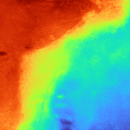
Mapping the ocean
BIFOLD researcher Dr. Panagiotis Agrafiotis, Postdoc at the BIFOLD research group “Big Data Analytics for Earth Observation”, developed MagicBathyNet, a benchmark dataset accompanied by low-cost tools for frequent, consistent, and joint bathymetric and semantic mapping of these areas, using only air and/or satellite-borne images.
BigEarth Project reviewed by CORDIS
The BigEarth Project, led by Prof. Dr. Begüm Demir, has been featured by CORDIS.

BIFOLD at IGARSS 2024
BIFOLD research group Big Data Analytics for Earth Observation (BigEarth), led by Prof. Begüm Demir, presented four papers at the IEEE International Geoscience and Remote Sensing Symposium (IGARSS 2024) in Athens, Greece. IGARSS 2024 scientific program focused on sustainable development in line with the United Nations 2030 Agenda.
