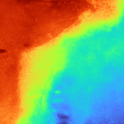
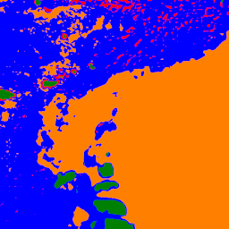
Accurate, detailed and high-frequent bathymetry
Bathymetric and semantic data play a key role
About 71 per cent of the earth's surface is water-covered. The 29 per cent land covered earth surface is completely mapped – most of it multiple times. But only a small fraction of the seabed is mapped by direct observation so far. The recognition of the importance of seafloor mapping has recently increased, driven by habitat destruction, pollution, cultural heritage at risk, natural disasters, navigation, offshore energy, and resource needs. Scientists are convinced that bathymetric and semantic data, play a key role in managing the oceans, supporting UNs’ Sustainable Development Goals (SDGs) or the EU Green Deal. BIFOLD researcher Dr. Panagiotis Agrafiotis, Postdoc at the BIFOLD research group “Big Data Analytics for Earth Observation”, chaired by Prof. Dr. Begüm Demir, developed MagicBathyNet, a benchmark dataset accompanied by low-cost tools for frequent, consistent, and joint bathymetric and semantic mapping of these areas, using only air and/or satellite-borne images. MagicBathyNet is the first publicly available multimodal dataset for these tasks, aiming to enable substantial progress in seabed mapping with deep learning. By offering ground-breaking data and tools to scientists, engineers, and policymakers, it will contribute to coastal risks mitigation and to complete and high-resolution EU seabed mapping by 2030.


The project actively contributes to the UN Sustainable Development Goals
Accurate, detailed and high-frequent bathymetry, coupled with the complex semantic content, is crucial for the under-mapped shallow coastal areas, being affected by intense climatological and anthropogenic pressures. “We will deliver AI tools for bathymetry and semantics of the challenging shallow water areas. This greatly benefits earth observation (EO), remote sensing and machine learning scientists, marine biologists/geologists, coastal engineers, hydrographers, and maritime archaeologists”, explains Panagiotis Agrafiotis, who chairs the project.
The MagicBathy project, now approaching its midway point, has achieved significant milestones, including the development of the MagicBathyNet benchmark dataset. “With this crucial resource now in place, we are poised to begin publishing our high-quality research findings. As we move forward, the most exciting and groundbreaking aspects of our research are on the horizon, promising innovative advancements in bathymetric and semantic mapping using remote sensing imagery”, knows Panagiotis Agrafiotis. By achieving high resolution mapping using only image-based EO data, a new industry will arise in hydrography and bathymetry, offering robust alternatives to current commercial methods. The resulting data will be multitemporal and of multiresolution, enabling frequent and consistent monitoring of the shallow coastal zone.
The project does not only have an enormous economic impact it also follows the “Do No Significant Harm” principle of Horizon Europe, and actively contributes to the UN Sustainable Development Goals (SDGs 13-14) as well as to the EU Green Deal. The results of the project will lead to the reduction of CO2 emissions in bathymetric mapping campaigns by using unmanned aerial vehicle (UAVs) and satellites. Results will contribute to safeguarding the shallow coastal environments.
The MagicBathy research project is funded by the European Commission under the HORIZON Europe MSCA Postdoctoral Fellowships - European Fellowships (GA 101063294).
Find the dataset under open source systems and tools: https://www.magicbathy.eu/magicbathynet.html


